


Voting District 090001, Chenango County, New York
About
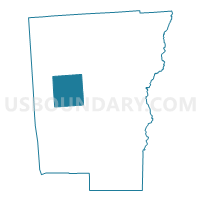
Outline

Summary
| Unique Area Identifier | 625998 |
| Name | Voting District 090001 |
| County | Chenango County |
| State | New York |
| Area (square miles) | 39.63 |
| Land Area (square miles) | 39.04 |
| Water Area (square miles) | 0.59 |
| % of Land Area | 98.50 |
| % of Water Area | 1.50 |
| Latitude of the Internal Point | 42.50171000 |
| Longtitude of the Internal Point | -75.72803910 |
Maps


Graphs
Select a template below for downloading or customizing gragh for Voting District 090001, Chenango County, New York


Neighbors
Neighoring Voting District (by Name) Neighboring Voting District on the Map
- Voting District 050001, Chenango County, NY
- Voting District 150002, Chenango County, NY
- Voting District 160001, Chenango County, NY
- Voting District 180001, Chenango County, NY
- Voting District 190001, Chenango County, NY
- Voting District 210001, Chenango County, NY
- Voting District 210002, Chenango County, NY
Top 10 Neighboring County Subdivision (by Population) Neighboring County Subdivision on the Map
- Oxford town, Chenango County, NY (3,901)
- Plymouth town, Chenango County, NY (1,804)
- Smithville town, Chenango County, NY (1,330)
- Preston town, Chenango County, NY (1,044)
- McDonough town, Chenango County, NY (886)
- Pharsalia town, Chenango County, NY (593)
- German town, Chenango County, NY (370)
Top 10 Neighboring Unified School District (by Population) Neighboring Unified School District on the Map
- Norwich City School District, NY (13,368)
- Greene Central School District, NY (6,971)
- Oxford Academy and Central School District, NY (5,359)
- Cincinnatus Central School District, NY (3,821)